
Air Monitoring
Ambient Air Monitoring Network
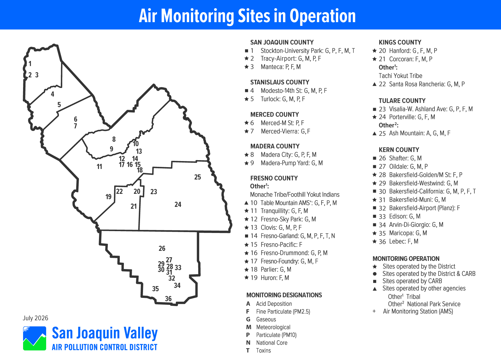
The District operates and maintains an expansive network of air monitoring sites throughout the eight counties of the San Joaquin Valley. A total of 24 sites are currently operated directly by the District or in collaboration with the California Air Resources Board (ARB). In addition, ARB also independently operates a number of air monitoring stations in the Valley, along with additional sites operated by the National Park Service and tribal nations. In total, 38 air monitoring sites are currently in operation in the San Joaquin Valley.
The Valley’s network reaches from the Stockton area in the north to the high elevations of Kern County near Lebec in the south, spanning over 250 miles. The air monitoring network measures concentrations of pollutants for which the U.S. EPA has established a health-based air quality standard. In addition, the network measures a number of meteorological parameters across the Valley.
Pollutants monitored include ozone, PM10 and PM2.5, nitrogen oxides, sulfur oxides, hydrocarbons, and carbon monoxide. In addition to routine monitoring, the District operates a network of five Photochemical Assessment Monitoring Stations (PAMS) focused on capturing volatile organic compounds (VOCs) during the summer season.
Air Monitoring Network Plan
The District prepares an annual Air Monitoring Network Plan and a 5-year Air Monitoring Network Assessment, which are both required by EPA. The Annual Network Plan and 5-year Network Assessment include a wealth of information regarding the air monitoring equipment operating in the Valley, along with details of upcoming changes to the monitoring network and analysis of how well the monitoring network covers the needs of the Valley’s population.
Other Links
Petroleum Refinery Air Monitoring
Real-Time and Recent Air Quality Information
- Real-Time Air Advisory Network (RAAN)
- 7-Day Summaries
- ARB's Air Quality and Meteorological Information Web Tool (AQMIS2)
- EPA's AIRNOW
Historical Air Quality Information
- Web-Based Archived Air Quality (WAAQ) System
- ARB's Air Quality Statistics (iADAM)
- EPA's Air Quality Information (Data Mart)
Community Air Monitoring
